Travel times: how far can you get in 10, 20 or 30 minutes?
On this page
Travel times shows, as shaded areas on the map, everywhere you can reach from one spot within a few minutes: 10, 20 and 30 minutes by car or by bike, or 5, 10 and 15 minutes on foot.
#Show travel times
-
Select Travel times in the ribbon. Or right-click any spot and choose Travel times from here, or select Travel times on a dropped pin's page.
-
Choose Car, Bike or Walk in the panel.
-
Click anywhere on the map. A pin drops there and the areas are drawn: the smallest for the shortest time, the largest for the longest.
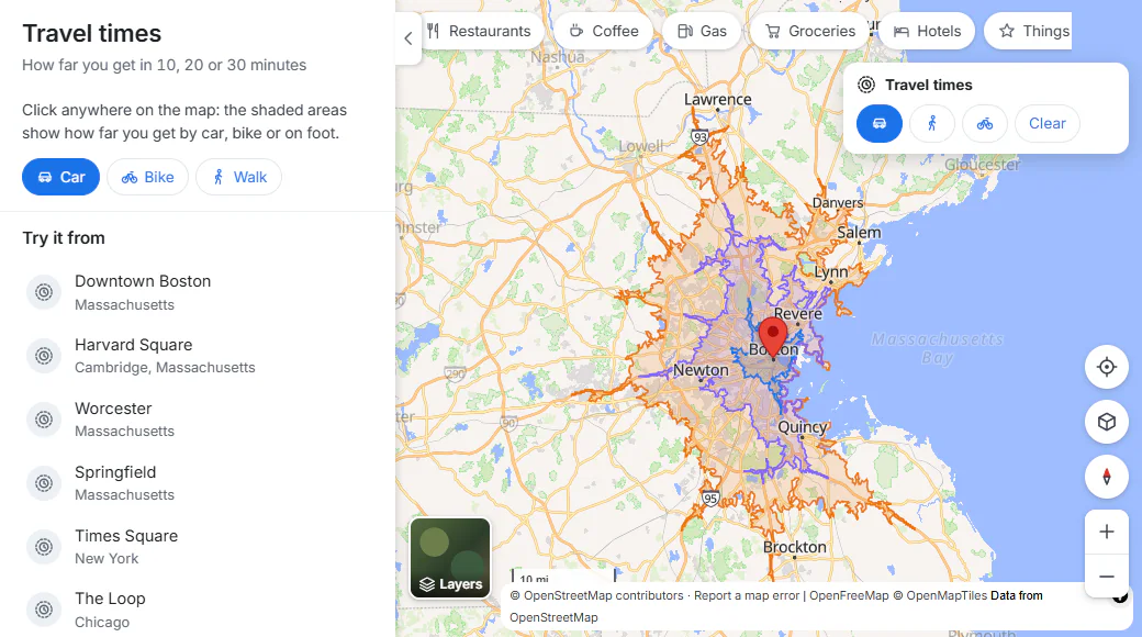
By car from downtown Boston: the nested areas show 10, 20 and 30 minutes.
- 1Car, bike or walk
- 2Switch the way you travel, or clear the areas
- 3Nested areas: 10, 20 and 30 minutes
-
Use the small Travel times box at the top right of the map to switch between car, walking and cycling for the same spot, or Clear to remove the areas.
The panel also lists places to Try it from, such as Downtown Boston, Harvard Square, Times Square and the Loop in Chicago.
#Reading the areas
- The areas are worked out on the actual roads and paths, assuming normal traffic and no stops or delays.
- The line at the top of the map says what you are looking at, for example "Reachable by car within 10, 20, 30 minutes".
- Car areas follow the roads a car may use; walking areas use footpaths and crossings; bike areas prefer bike paths and quiet roads.
#Common questions
Why is the area not a circle?
Because you travel along roads and paths, not in a straight line. Fast roads stretch the area out along them; water, railways and missing bridges pinch it in.
Does it include traffic or public transit?
No. It assumes normal traffic, and it covers driving, cycling and walking only.
Why do I get a message that travel times are not available?
They depend on the same service as directions. If it is busy, try again in a minute; if the message says travel times are not available on this server, the site does not offer them at the moment.